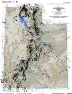
Earthquake database for Utah Geological Survey Map 277: Utah earthquakes (1850–2016) and Quaternary faults: Earthquake Catalog (31,909) & Coal Mining Region catalog (24,493)
 The earthquake database described here consists of catalogs (chronological lists of origin time, location, and size), along with explanatory information, for the earthquake epicenters shown on Utah Geological Survey (UGS) Map 277, Utah Earthquakes (1850–2016) and Quaternary Faults (hereafter, “the map”; Bowman and Arabasz [2017]). The seismic events depicted on the map include both tectonic earthquakes and mining-induced seismicity (MIS) associated with underground coal mining in east-central Utah.
The tectonic earthquake data are primarily from a Uniform Moment Magnitude Earthquake Catalog developed for Utah and its surrounding region by Arabasz and others (2016) for the time period 1850 through September 2012. For the map, we extended the catalog through December 2016 and expanded it to include earthquakes smaller than magnitude 2.9. MIS was excluded from the compilation of Arabasz and others (2016) but has been added to the map to show its significance in east-central Utah.
- ArcGIS files and Excel Spreadsheet
