Average Shear-Wave Velocity Maps
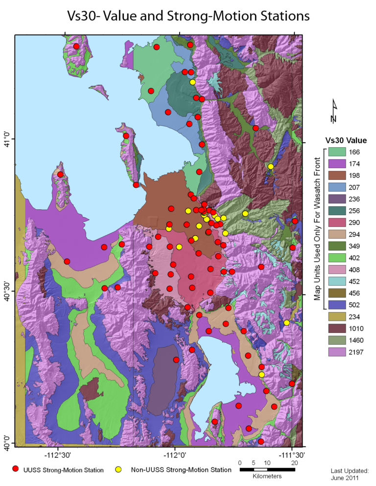
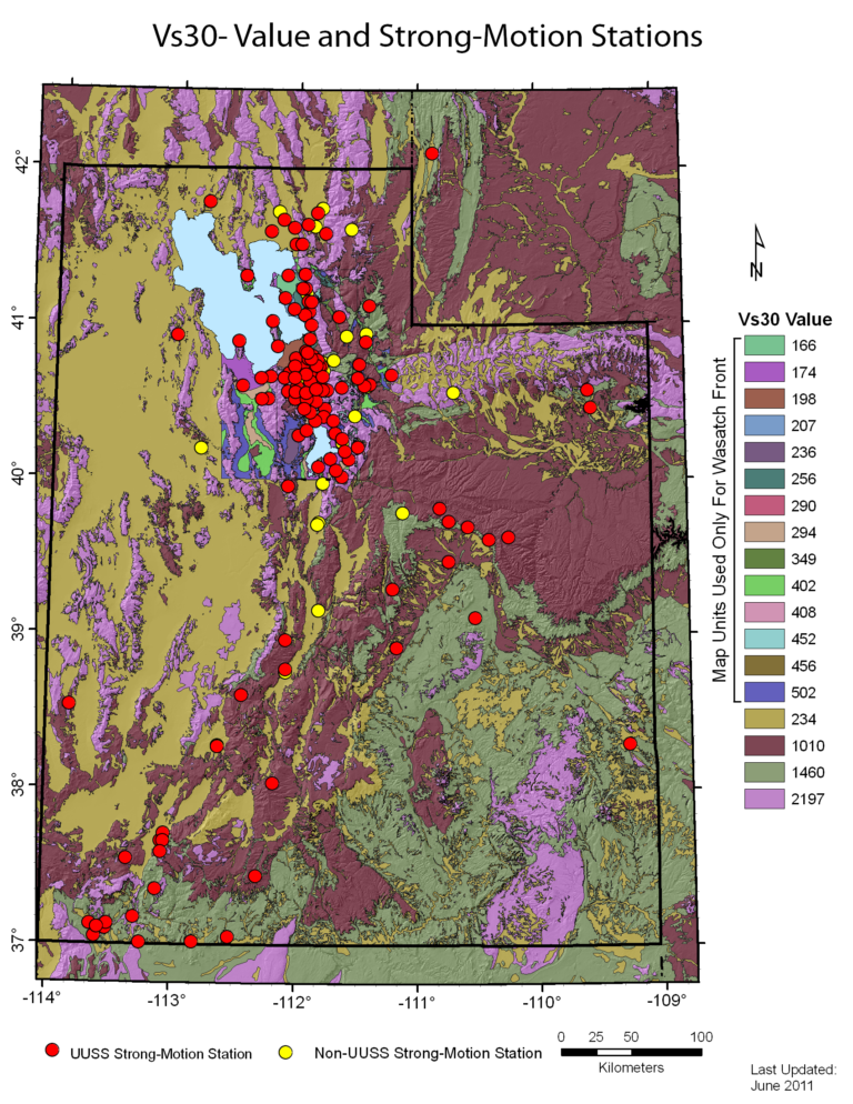
Geologic (earthquake) site conditions such as soil grain size (clay, silt, sand, and gravel) and rock type influence levels of earthquake ground shaking experienced at a site. Research has shown that certain soil and rock types amplify or deamplify ground shaking, and that the average shear-wave velocity (Vs) in the upper 30 m (Vs30) provides a good predictor of how soil and rock will behave in an earthquake. The International Building Code uses Vs30 to help design earthquake-resistant structures based on geologic site conditions. The maps show the average shear-wave velocities (Vs30) of geologic site-conditions units for the Wasatch Front urban corridor, from North Ogden in Weber County to Payson in Utah County, and overall for the Utah region. Along the Wasatch Front, the units are based on geologic maps, borehole logs of soil and rock types, and measurements of shear-wave velocity retrieved using various downhole and surface geophysical techniques. The majority of the Wasatch Front urban corridor map is based on geologic site-conditions units defined in Utah Geological Survey Special Study 125 (McDonald, G.N., and Ashland, F.X., 2008, Earthquake site conditions in the Wasatch Front urban corridor, Utah). The Utah region map is more generalized and based mainly on geologic units; average Vs30 values for each unit are estimates because Vs30 measurements are few outside the Wasatch Front.


